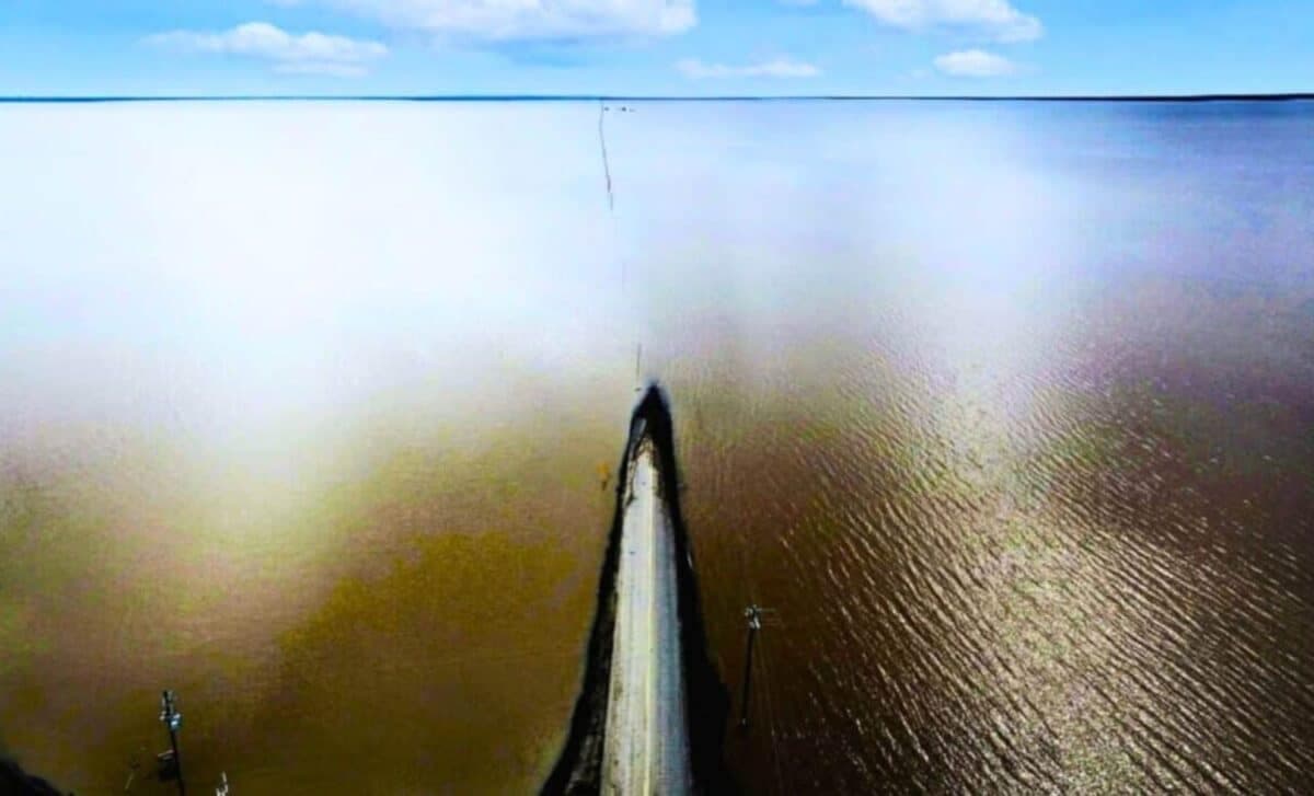
A lake that had been absent from the map for more than a century is back in Kings County, occupying the low basin south and east of where its shoreline once sat. In the Yokuts language, Pa’ashi means “big water.” The name has acquired a very literal quality.
The resurgence of Tulare Lake has submerged nearly 100,000 acres of farmland, including ground planted to pistachios and almonds. Evacuations have followed, and agricultural operations in the flooded area have stopped. The return of the lake is less a tidy historical recurrence than a working landscape losing its footing.
A Basin Built to Be Dry
Tulare Lake was drained by the late 19th century through canals and diversions that made large-scale farming possible. Its disappearance was treated as an engineering achievement. The basin, however, never forgot what it was shaped to hold.
The recent flooding has exposed the limits of a water system built around moving water away, storing it elsewhere and drawing heavily from below ground when surface supplies fall short. The lake bottom has also shifted because of subsidence caused by groundwater pumping, changing where future floodwater may collect.
That shift matters to growers near Corcoran and elsewhere in the Tulare Lake basin. A landscape that looks familiar from the road can carry a different elevation beneath the orchard rows, the result of years of pumping and uneven sinking. Reporting on the basin has linked that movement to a shoreline moving south and east.
The Ground Beneath the Orchards
The flooding arrives as the San Joaquin Valley is already being asked to correct its groundwater balance. Under the Sustainable Groundwater Management Act, the Tulare Lake and Tule subbasins face the work of bringing overdrafted basins into sustainability by 2040. The state has placed the Tulare Lake subbasin on probation over inadequate plans to slow pumping and address the damage left by subsidence.
For specialty-crop operations, the problem is not confined to a flooded field. Wells, pumps, fuel systems, buried lines and other agricultural infrastructure can end up underwater. That creates a concern beyond lost access: chemicals or residues associated with submerged equipment and facilities could enter groundwater, adding a water-quality question to an already expensive recovery.
The cost of managing that problem does not necessarily follow the boundary of the farm that pumped the water. In Kings County, even a district that relies on river recharge rather than contributing heavily to the overdraft has supported assessments for groundwater management. Local districts are being drawn into the bill, because the basin's hydrology is shared whether the pumping is.
A Flood With a Long Tail
The immediate work is practical and unglamorous: keep people out of unsafe areas, account for damaged infrastructure and determine what can be salvaged when fields become accessible. For almond and pistachio growers, the timing of that access will shape pruning, irrigation, harvest planning and decisions about whether an orchard can return to production.
The larger question is how much of the basin can remain in permanent or intermittent production while water managers try to stabilize the ground beneath it. Estimates cited in regional coverage suggest that substantial acreage across the southern San Joaquin Valley may eventually have to leave production as groundwater overdraft is addressed. The lake makes that abstract acreage visible.